yobit eobot.com

Announcement

Collapse
No announcement yet.

@ those that know...

Collapse
X
 
  • Filter
  • Time
  • Show
Clear All
new posts

  • @ those that know...

    I've had a look on the shropshire council site and found this
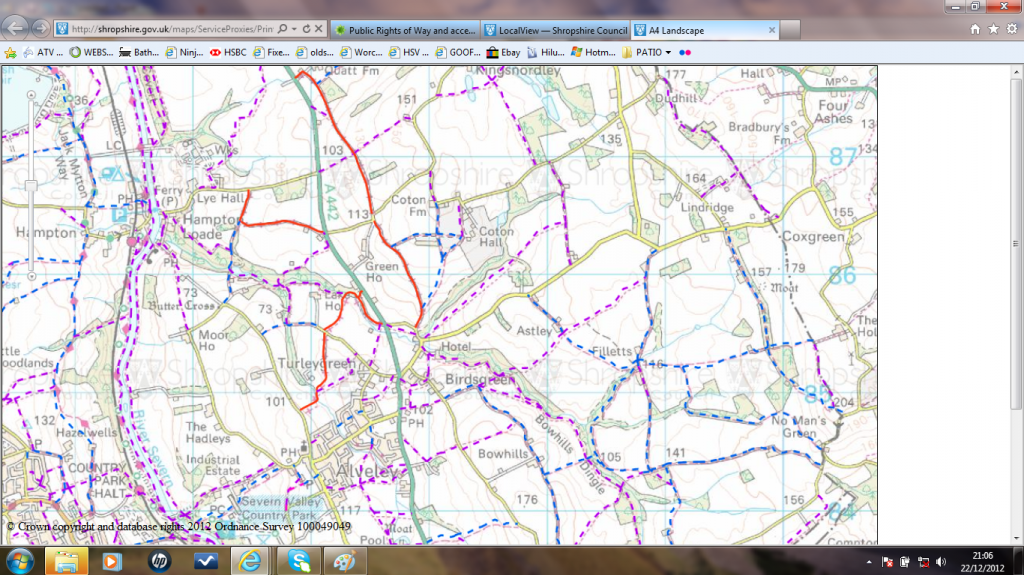
    The red routes are BOATS.
    Can I safely assume they all open? Or is there another source of info I need to check?
    Printed off the ones I want, and might give them a go tomorrow - I "found" a short stretch by accident today. It led down a green lane and then actually followed the stream for 100 yards... 18" deep... fantastic adrenalin rush.
    So I'm off to find some more tomorrow...
    Last edited by Wolfracer; 22 December 2012, 22:30.
    "B.A." Baracus: "Talk to me, talk sense so I can talk back. Not all this jibberjabber like breaking the peace and all that."
    www.johnthebuilder.info

  • #2
    The councils are the ultimate place to go and check ROW's, they hold the 'definitive maps' and are supposed to keep them up to date and list any TRO's that effect routes.

    You might want to check the actual online maps are up to date with somebody there though, not sure if all councils are the same.
    4x4toys.co.uk - Keeping you on and off the road...

    Comment


    • #3
      If you check on the same website you used they should list any TRO's, if not then they may have signs at the actual routes.


      LOL what he /\ said ;0
      Eat.Sleep.Surf.Repeat.

      Comment


      • #4
        Can't see any TRO's on the website, but will certainly check the start and end of every lane for possible signs.

        If any are as good as today's little find, I'll be well impressed. Driving through a flooded "stream" seems to highten your senses slightly!
        "B.A." Baracus: "Talk to me, talk sense so I can talk back. Not all this jibberjabber like breaking the peace and all that."
        www.johnthebuilder.info

        Comment

        Working...
        X